
Research
Chesapeake Bay Bald Eagle Tracking Project
On Memorial Day 2002, Earthspan launched a new research project in cooperation with the Maryland Department of Natural Resources. The project involves the tracking of four rehabilitated immature Bald Eagles.
More Information
Padre Island/Assateague Island Peregrine Falcon Survey
During the past three decades, Earthspan associates have conducted a comprehensive study of the tundra peregrine falcon (Falco perigrinus tundrius)
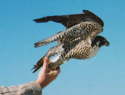
throughout its breeding, migratory, and wintering range. We have conducted migration studies on the tundra peregrine and other sub-species on Assateague Island, VA, since 1970 and on Padre Island, TX, from 1978 to present day.
2003 Assateague Island Peregrine Falcon Survey Report
2003 Padre Island Peregrine Falcon Survey Report
Partners in Flight Report: Travel Routes and Distances of Migrating Peregrine Falcons and Swainson’s Hawks
Crossband Transponder: A System for Tracking and Monitoring Small Birds and Bats
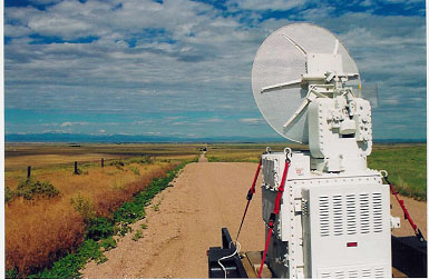
Earthspan is working under a National Science Foundation grant to develop a new system that can track and monitor small birds and bats for multiple years.
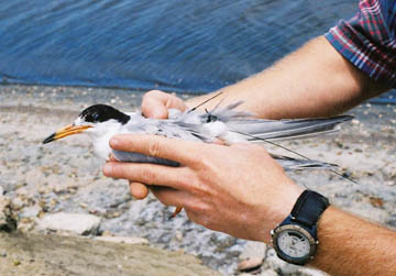
California Least Tern Project
Earthspan is teaming with California scientists to develop Crossband Radar System tracking techniques to help protect the endangered California Least tern.
White-faced ibis:
As An Indicator Species to Discover Sources of DDT Contamination of Migrating Birds. In 2001 and 2003 we PTT tagged contaminated white-faced ibis at Stillwater National Wildlife Refuge and
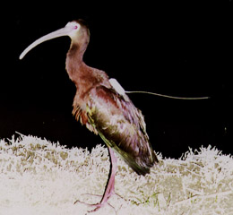
tracked them to their wintering grounds. We sampled their foraging areas and will report the results of the chemical analysis.

Assesment of Deer Vehicle Collisions Using GIS and GPS
In an Effort to Reduce Deer Vehicle Collisions, Earthspan worked with the Maryland State Highway Administration to create a Deer Strike Reporting System.
Broad-Winged Hawk Migration Paths and Wintering Areas
Little is published about the wintering ranges of broad-winged hawks in Central and South America. In June of 2000 Earthspan satellite tagged broad-winged hawks in Western Maryland and Central Minnesota. We then tracked them to their wintering grounds and back. This is the first study to satellite track broad-winged hawks.
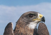
Mexico Peregrine Research
In 1997 and 1998 Earthspan, in collaboration with Fundacion Ara, studied peregrine falcons (Falco peregrinus)
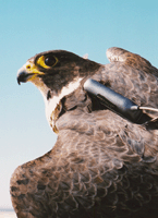
wintering on the Mexican Gulf Coast to better understand their habitat requirements and movements. Other objectives were to track peregrines via satellite to their breeding areas, and back to the wintering grounds in Mexico. Eight birds were monitored on their southward migration. Like their northward migration, their southward routes were through the middle of the continent. Autumnal migration was initiated in August and September. Peregrine falcons arrived on wintering grounds in September and October. PTT data and capture locations of birds caught in more than one year indicate that peregrines use the same area of beach (and relative range size) for wintering year after year.
Read the Final Report of Our Peregrine Reseach on the Gulf Coast of Mexico Location maps are not available on line due to their large size.
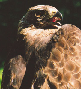
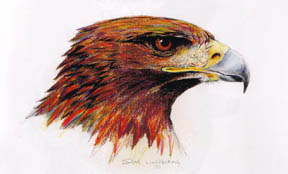
Excerpts for the Final Report of a Study of the Golden Eagle In Mexico
In 1997 and 1998 we perforned a satellite telemetry and breeding habits study of golden eagles in nort-central Mexico
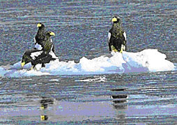
Steller’s Sea Eagle Tracking in Russia
In 1997 we PTT tracked Steller’s sea eagles in the Sea of Okhotsk and on the Kamchatka Peninsula of Eastern Russia. This was the first use of satellite telemetry to track the movements of this magnificent eagle.
Swainson’s Hawk PTT Tracking
In 1995 and 1996 Earthspan teamed with scientists in five western states and two Canadian provinces to satellite track Swainson’s hawks to their wintering (Austral summer) grounds . This effort identified the source of a major threat to the species.
From 1995-1997 we demonstrated Satellite Telemetry techniques on Five Military Bases in the Westen United States. Resourse managers can now use this technology to map animal movements to conserve wildlife and maintain readiness.
Oryx at White Sands Missile Range, Nevada
White Pelicans at Naval Air Station Fallon, Nevada
Feral Horses at Dugway Proving Ground, Utah
Golden Eagles at Orchard Training Area, Idaho
Ferruginous Hawks at Hill AFB, Utah
Final Report of Satellite Telemetry Demonstration for the Department of Defense Legacy Resource Management Program